Warm current in the Gulf of Mexico could cause Katrina-level hurricane in 2022 season
On June 1 the Atlantic hurricane season has begun. National Oceanic and Atmospheric Administration previously forecasted active season due to warmer waters in the Gulf of Mexico, expecting up to 20 storms and 4-6 major hurricanes. But latest water temperature data indicates brewing conditions similar to what happened in 2005 — the year of Katrina.
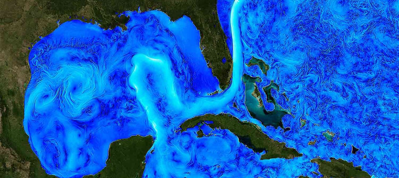
The main dynamical feature of the Gulf of Mexico is the Loop Current, which is a portion, upstream of the Gulf Stream, of the North Atlantic western boundary current that carries ocean waters from the Tropics towards the high latitudes. Every summer, the whole Gulf of Mexico is marked with high sea surface temperatures, which support the formation and presence of tropical storms and hurricanes.
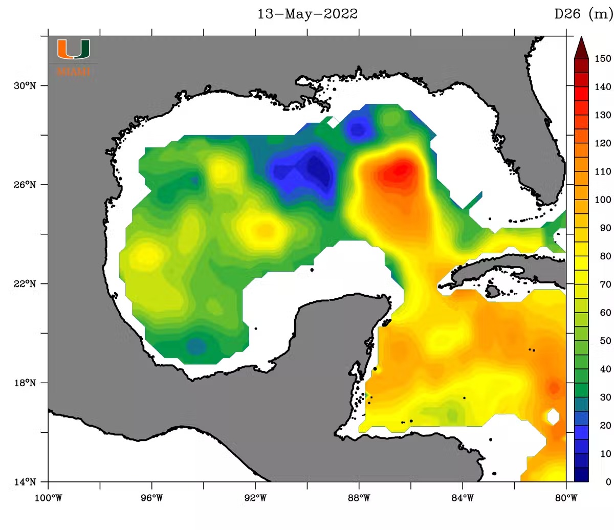
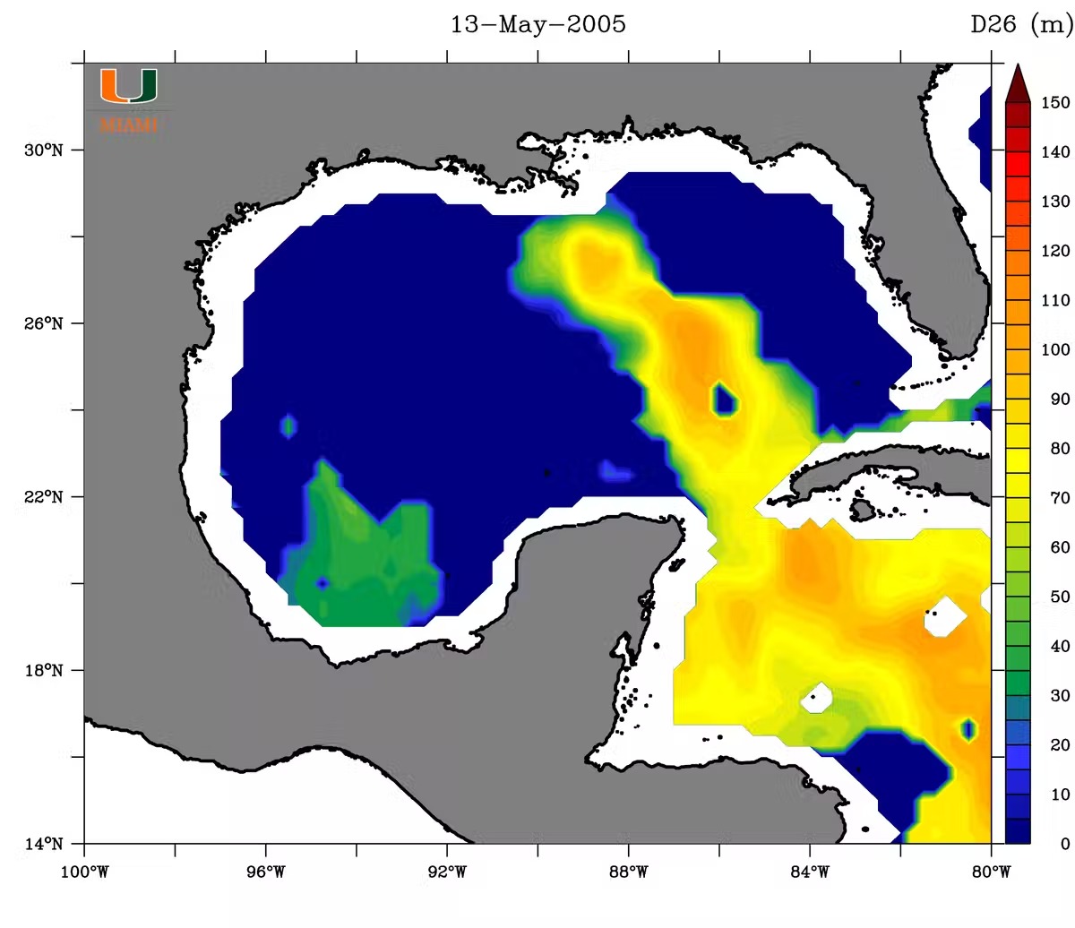
Observations of the Loop Current made in mid-May show structure similar to 2005 observations:
Warm water by itself is not a cause of the hurricanes, but it can strengthen existing ones. It happens when top 100 feet of the ocean reaches 78 F or more. And the Loop Current's water is warmer at greater depth, and saltier, inhibiting surface cooling, which allows hurricanes to gain more power as they move to the north.
Mid-May observation showed that water temperature in the Loop Current reached 78 F at the depth of 330 feet. During summer surface temperatures could exceed 86 F, warming water up to 600 feet, and leading to Category 4-5 hurricanes.
As of now it's impossible to say how 2022 conditions will affect hurricanes, but the next several weeks should clear the picture. However, National Hurricane Center encouraging early preparations for the U.S. residents, and you can find out 7 key things to do before season arrival.