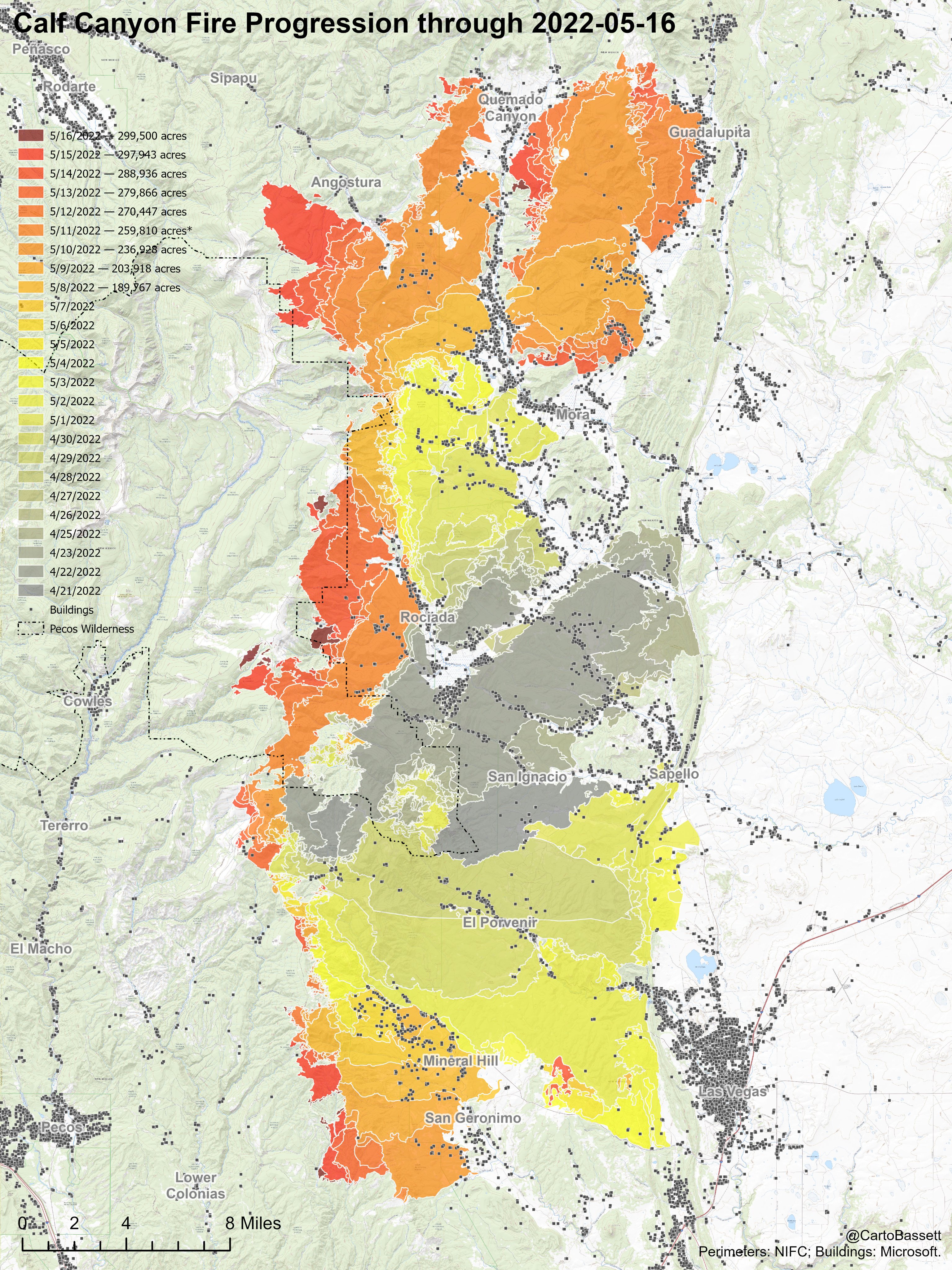
Rain and hail slowed down Hermits Peak and Calf Canyon Fires — just 500 acres shy of 300,000
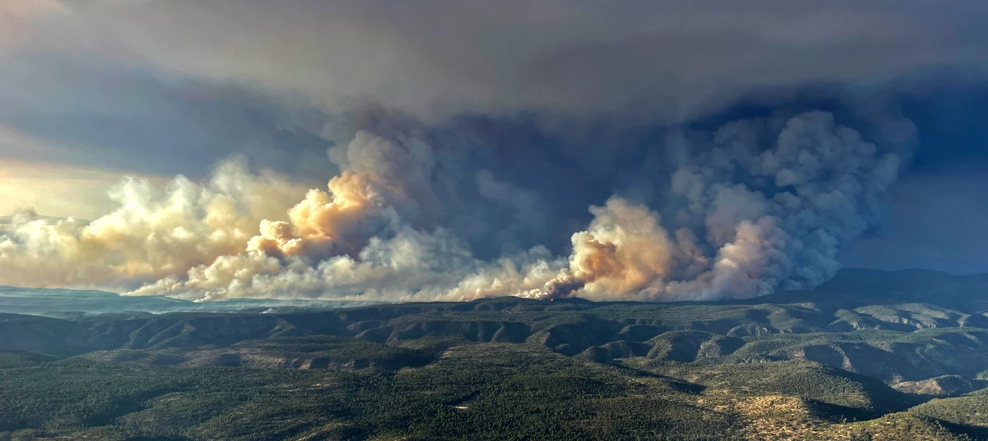
Yesterday due to humidity recovery and winds speed decrease the largest fire in New Mexico history slowed down, adding to its tally 1,557 acres, to the total of 299, 565 acres.
Today partial clouds with a warming and drying trend expected. Winds shifting back to a more west to southwest direction. Maximum sustained winds will be west-northwest at 16-21mph with gusts to 28 mph across the higher exposed areas, south-southwest 11-14 mph with gusts to 20 mph for the valleys and sheltered areas. High temperatures will be in the 70sto near 80F. Minimum relative humidity values will be in the 5 to 10 percent range.
Slightly cooler and improved atmospheric moisture are forecast for the fire area along with south-southwest winds in the 25 mph range. Expect fire on the western flank to make ridge- and drainage runs to the northeast, producing columns with half-mile spotting.
Most drainages on the west are aligned NE/SW, which will favor these wind/drainage aligned runs. Threat of thunderstorm development with associated strong outflow winds could produce rapid spread in a variety of directions. No spread expected on south or east flanks, but strong outflow winds could test these lines.
In the Central zone fire activity expected to increase as winds begin to ramp up again as they come out of the SW.
Planned Actions
South Zone:
North and east sides of south zone secure fire edge, mop up, monitor and patrol. On Southern flank continue to construction of contingency lines to the south. On western flank of fire continue direct and indirect line construction. Continue identification and construction of contingency lines west. Continue structure protection implementation and structure triage in the Pecos River Corridor.
Central Zone:
North - Continue a combination of direct and indirect line construction to prevent further northward growth of the fire between DP 352 and DP 188. Continue direct line construction West of DP188 west towards FR 76.
East
Patrol the 434 road. Prevent further structure loss. Continue to prepare structures moving north as resources allow and conditions require. Evaluate alternatives and establish contingencies in the event the fire crosses the 434 road.
South
Prevent structure damage in Mora and along communities in the adjacent corridors.
West
Prevent structure loss along Highway 518 near Angostura. Identify primary and secondary line locations N of 518 to Black Lake.
Structure Group(s)
Combined structure groups will continue to prep and prepare for structure defense and prep as condition and time available allow. Efforts will be prioritized based on probability of success and proximity of of VARs to threat.
Other
continue to coordinate with the local utility companies to allow for operation of critical infrastructure. Continue to coordinate with law enforcement agencies to account for public safety.
North Zone:
Continue strategic planning and assessments for the North Zone, working on a draft strategic plan. Work with the communities in the North Zone and then an East Zone in transition, to identify values at risk and address concerns from the community and cooperators. Develop evacuation zones in coordination with the other zones, and continue to communicate and coordinate progress. Coordinate with other Incident management teams in transition from the North Zone to an East Zone with resources and strategies.