Cerro Pelado Fire spread is slow but steady — 42,491 acres burned
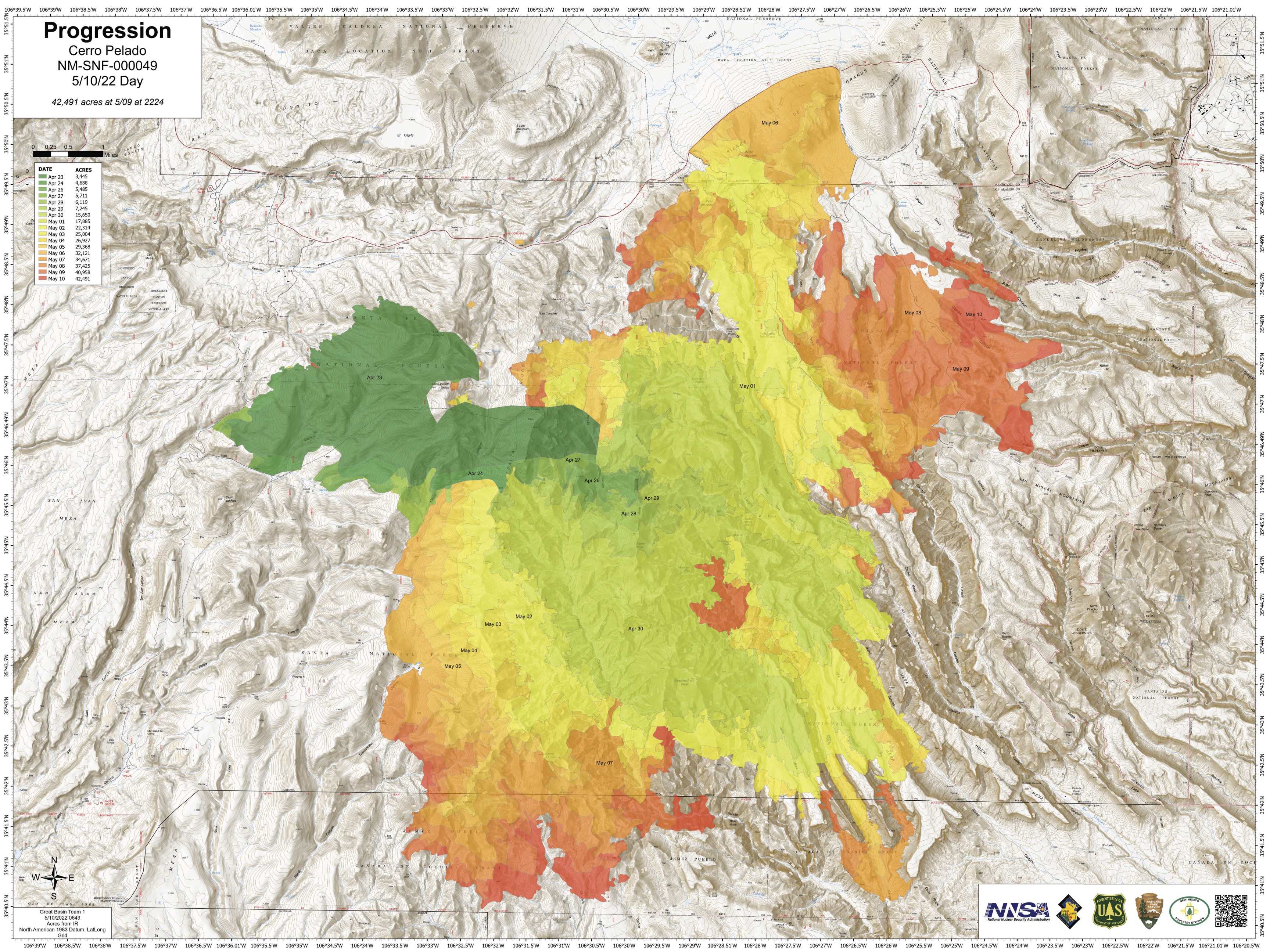
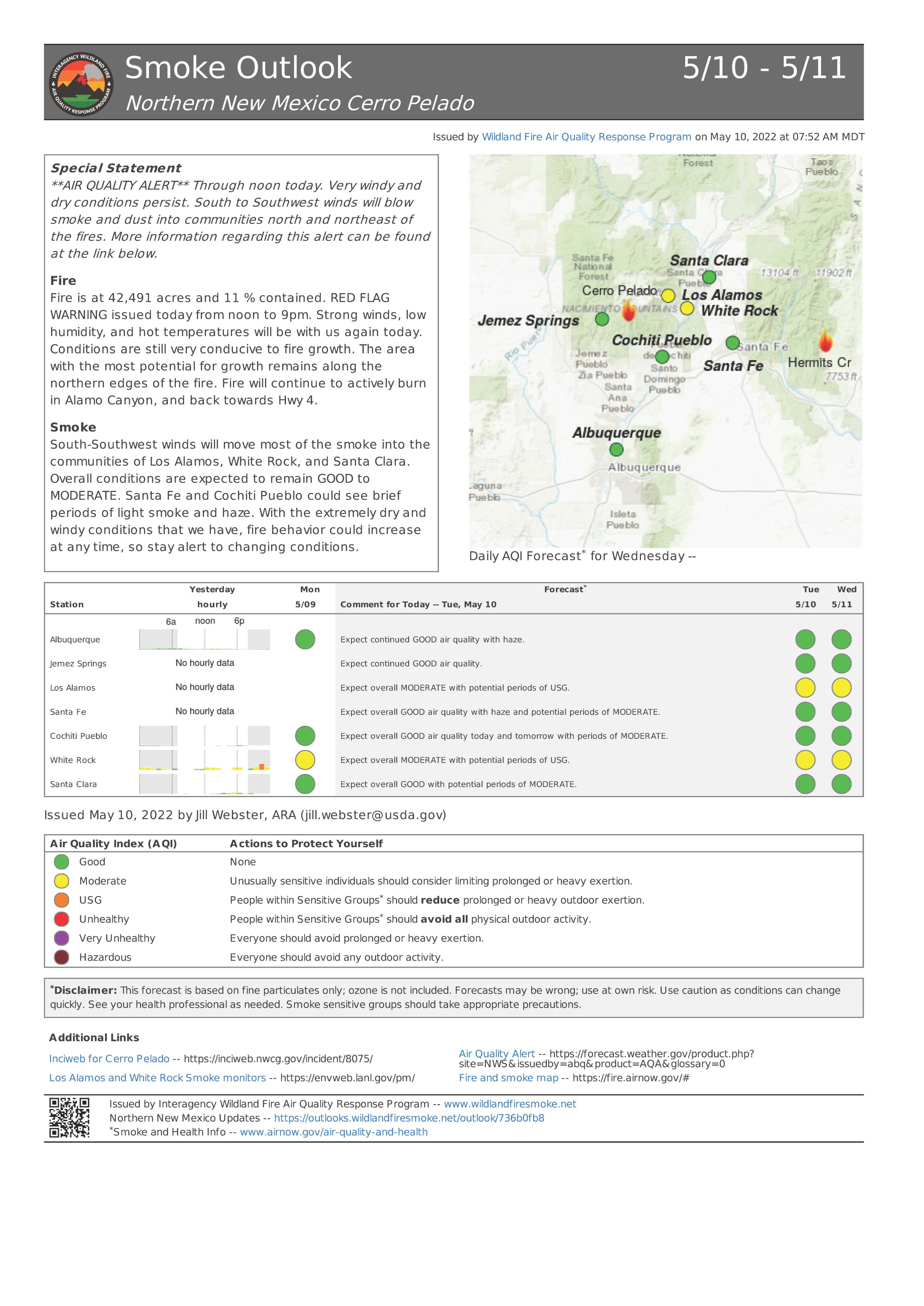
Second largest wildfire in New Mexico today is Cerro Pelado. The latest update indicates that the total affected area at 42,491 acres as of 9 AM on May 10. High winds over the weekend increased the spread but it is significantly slower than Calf Canyon and Hermits Peak Fire. Even thought perimeter containment at 11%, full containment estimated on May 21.
A weather system passing to the north will bring increasing winds Wednesday with gusts to around 40 mph. With the stronger winds and low relative humidity a Fire Weather Watch has been issued for Wednesday.
Downslope winds may combine again, expounding the wind and causing containment issues most of the night. The rest of the fire will likely experience wind, but no containment issues.
Over the next 24 hours winds will be less intense, but still fairly strong from the southwest. Low relative humidity, temperatures in the 70s, and a moderate chances of extreme fire behavior. Fire growth to the northeast is still possible. Spotting with a high probability of ignition if embers land in receptive fuels. Los Alamos Laboratory may be threatened.
Highway 4 remains closed to all traffic from mile marker 34 to mile marker 50 (at the junction of Hwy 4 and 501) due to fire activity. Fire equipment and firefighters will be working along Highway 4 and accessing the fire, especially at intersections with FR 10 and FR 280. Heavy traffic impedes firefighting efforts and endangers firefighter safety.
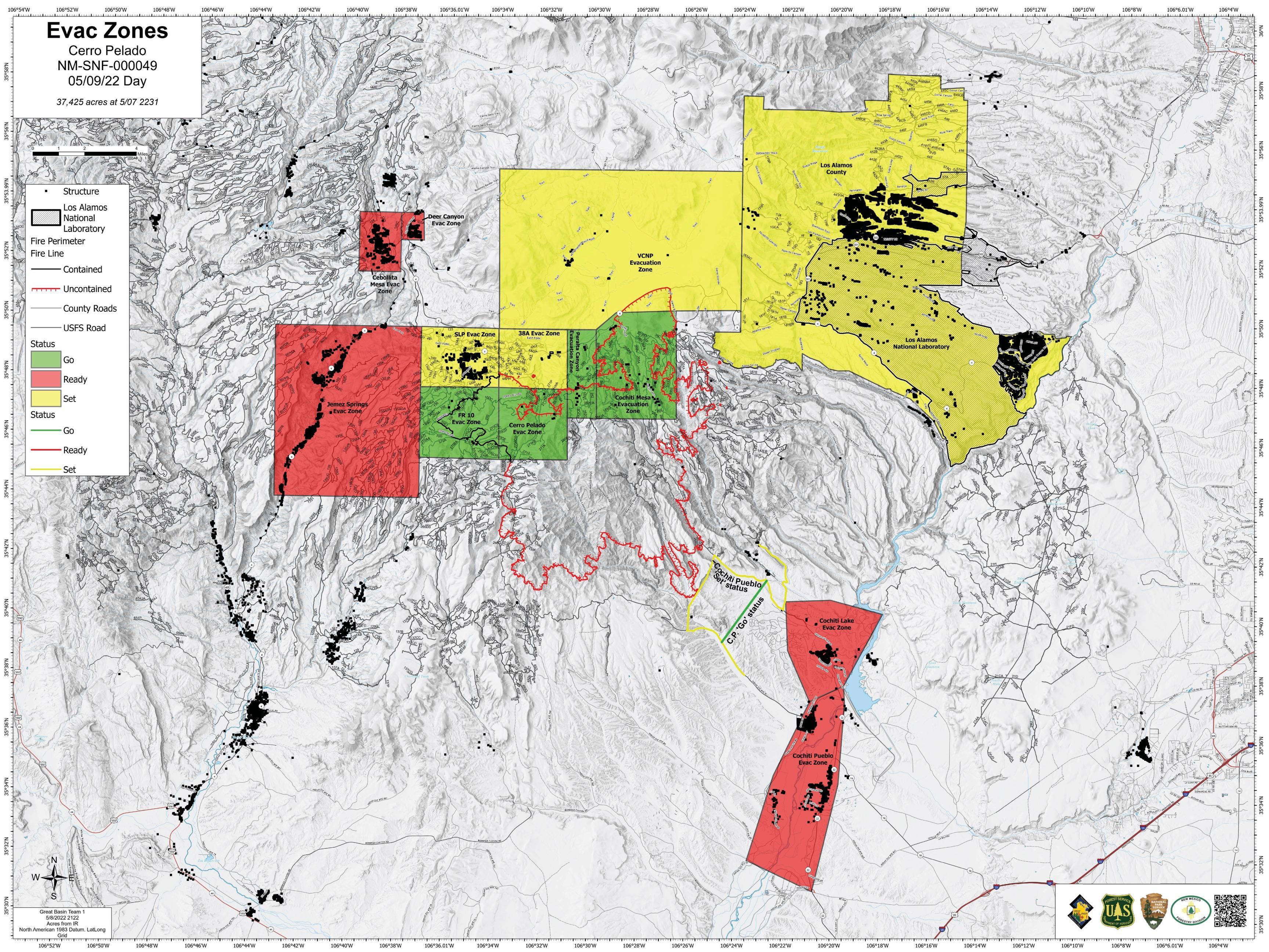
Evacuations and Shelter Areas:
The Santa Fe National Forest has issued a closure order for the Cerro Pelado fire area and a second closure order for the Cerro Pelado Firefighter Camp along FR 376. The purpose of both orders is to protect public health and safety due to extreme fire danger in the Restricted Area.
The communities of Cochiti Mesa and the Peralta Canyon area, including Cox Ranch, remain under a “Go” evacuation status. The Sandoval County Fire Department and Emergency Management will provide updated information on evacuations as needed. Evacuations for Sierra de Los Pinos and Valles Caldera National Preserve remain in “Set” mode, meaning residents should be ready to leave at a moment’s notice. These areas could return to “Go” if conditions change and the fire threatens the community again.