Climate change introduced wild fluctuations in California snow water supply
NASA's image of the day for May 9, 2022 presents a grim picture of California's water supply future. Over the 2021-2022 winter season ground and satellite observations of Sierra Nevada presented have shown extreme fluctuations in snow development, causing concern about the impact on water resources.
Noah Molotch, a mountain hydrologist at the Institute of Arctic and Alpine Research (INSTAAR) and NASA’s Jet Propulsion Laboratory said:
The Sierras tend to get big storms, with a lot of snow in bursts, or we get years of very little snow. It is rare that we have a snow year that is actually average.
This past winter was one of extremes within an overall downward trend. These are natural events that could normally happen, but global warming has amplified everything. The trajectory of climate change has put us on a path where the normal wild swings of winter are now warp-drive wild.
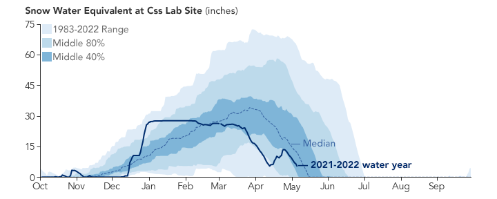
Such an unusual pattern led to a significantly diminished snowpack in 2022. Snow water equivalent, measuring how much water California would get if all of the snow in a given area melted at once, on April 1 stood at just 37 percent of the long-term average.
Snow water equivalent on December 30 was calculated to be 160 percent of normal, followed by driest January —March period. Early sprig heatwave melted snow prematurely, but late season storms gave the mountain snowpack a boost. At the beginning of May Sierra Nevada snow water equivalents were back down to 27 percent of normal.
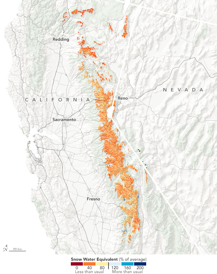
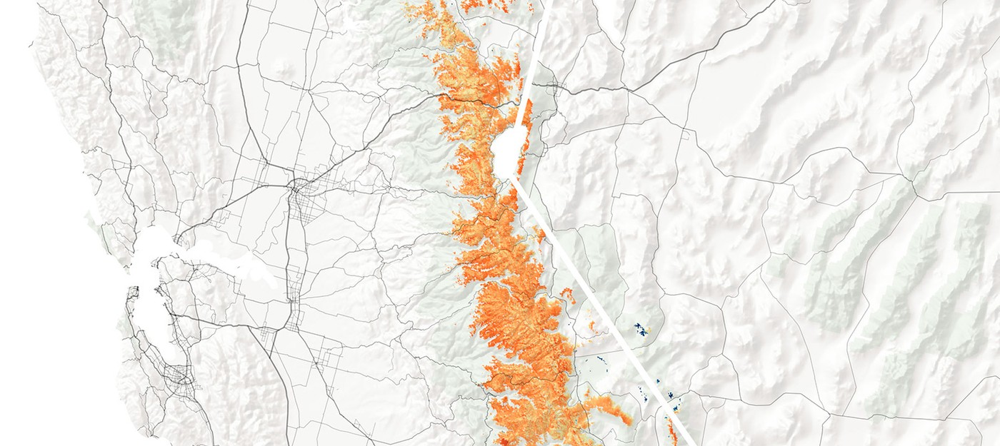
To understand snowpack development and prepare measures, an experimental model was developed, depicting snow water equivalents on April 24, 2022, and comparing them with the long-term average.
As of INSTAAR’s April 24 report, the percent of average SWE above 5,000 feet elevation was highest in the central region of the Sierra Nevada (61 percent), then the north (47 percent), and lowest in the south (41 percent). Just one week later, those numbers dropped to 42 percent in the central Sierra, 33 percent in the south, and 26 percent in the north.
Benjamin Hatchett, a hydroclimatologist at the Desert Research Institute said on topic:
Our natural water tower is becoming leaky. If snow is melting earlier, that means water is coming out of our natural mountain reservoir earlier. This also means we have to manage it downstream when we might not have the flexibility that we would like.
Warming and drying will lead to more snow-free days, and snow will start melting out earlier. As this climatology continues to shift, how will the surface and the groundwater hydrology respond to the low snow conditions, the singular extreme years, and the back-to-back dry years?
We really need a better set of observational tools and modeling systems from the atmosphere to the bedrock to understand these changes.

Natural-color satellite images show the progress of the snow season and help scientists assess the extent of snow cover, but not the depth.
- Satellite data reveals unprecedented low in Antarctic sea ice