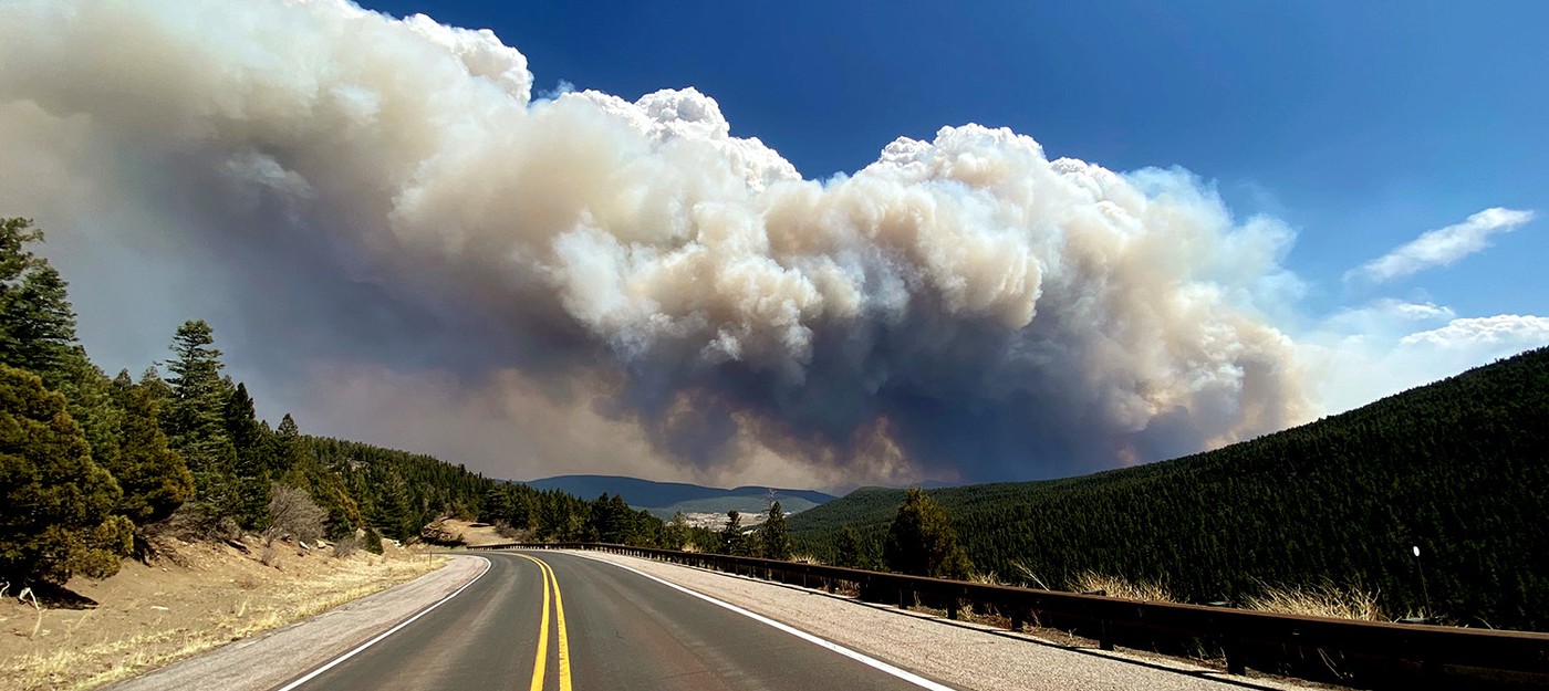
Firewatch: Calf Canyon and Hermits Peak Fires estimated at 120,000 acres
New Mexico Fire Information posted an update on Calf Canyon and Hermits Peak Fires, reporting that the total affected area now at 120,653 acres. More than a thousand firefighters involved in operations, and containment at 20%.
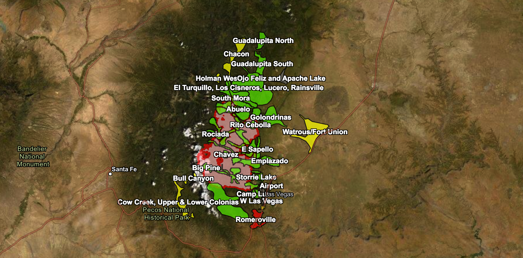
Changing winds pushed the fire north toward Mora and northwest toward Las Tusas and Sapello on May 1st. Overnight, the fire moved south toward Las Vegas. Evacuation levels continue to change — local residents can check updated maps.
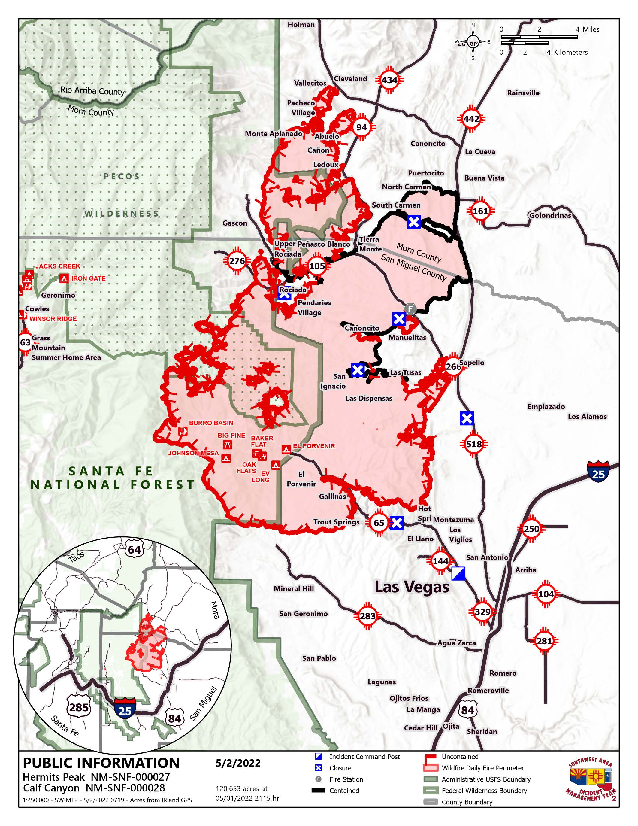
Crews remain engaged in structure protection in four groups across the fire, constructing line, and reinforcing existing roads and natural features as holding points. Homes and water sources are among the main objectives for firefighters.
During the briefing on April 30 Incident Commander Carl Schwope said that the fire "could easily double in size, maybe even bigger than that" due to high winds and drought.
You can find the latest evacuation map below or directly via the link. Map also available via QR code.

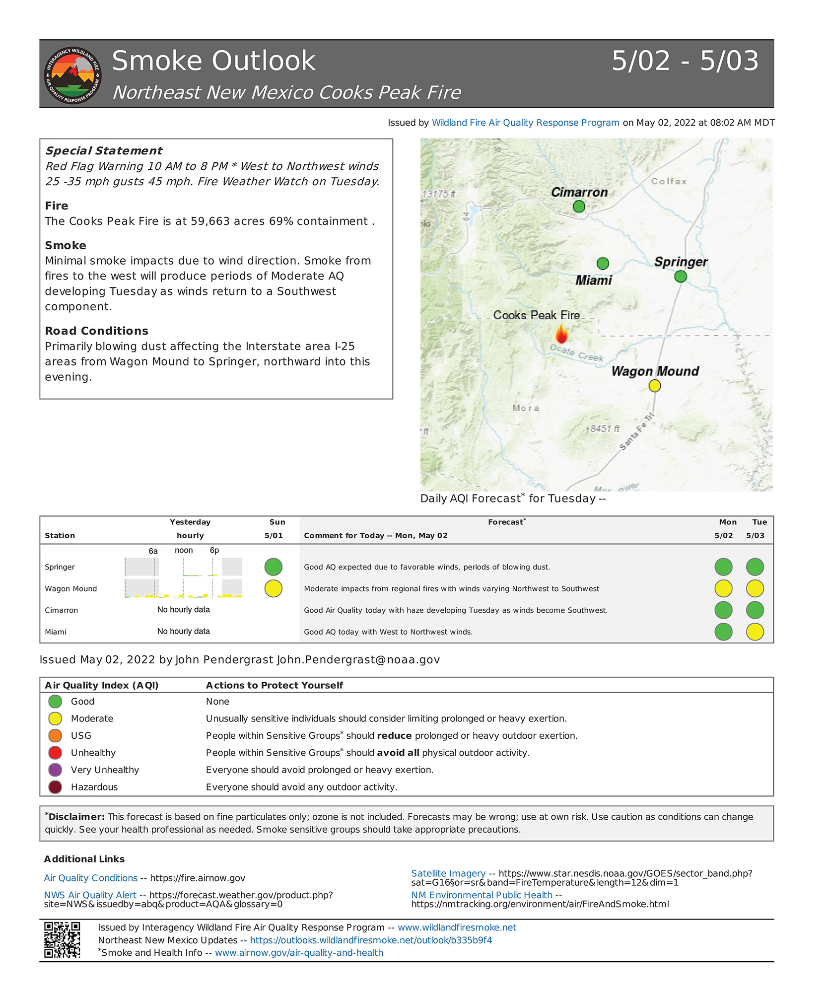
The Las Vegas area will see Unhealthy for Sensitive Group (USG) conditions today into tonight, becoming moderate to periods of USG Tuesday as southwest winds return. Expect air quality (AQ) reduction late evening into overnight as smoke drains into the valley.
Mora will experience USG smoke in the area early, becoming moderate mid-morning into early afternoon, switching to moderate to USG late afternoon. AQ around Rociada, Pendaries, Buena Vista, and Sapello today should range from Unhealthy to periods of USG as fire activity continues adjacent to the area. An interactive smoke map allows to zoom into your area to see the latest smoke conditions.